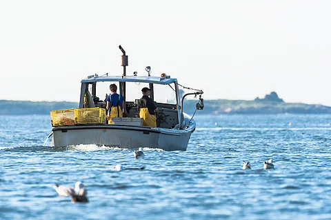

Lobster fishermen at work in South Bristol, Maine, United States.
Photo: Adobe Stock.
New research is shedding light on how fishing communities along the U.S. Northeast seaboard are adapting to the sweeping impacts of climate change.
A team of researchers led by Rebecca Selden of Wellesley College, Massachusetts, have examined 266 fishing communities from North Carolina to Maine over a 5-year period, developing a “spatial sea map” to document how each community is adjusting its fishing practices in response to shifting marine ecosystems.
Published in the ICES Journal of Marine Science on October 15, the study is one of the first to provide highly detailed, community-specific insights on fishing adaptation. It reveals how various communities alter their fishing locations, gear types, and targeted species in response to climate pressures, such as rising ocean temperatures, acidification, and species migration.
“These changes can challenge fishing communities that rely on marine resources. Many communities have diversified what they catch, or where they fish, to cope with changes in where fish are found... We need to understand what works in different locations,” Selden said in a news release.
"So many fishermen have an immense capacity for change. It’s often regulations that are the limiting factor. By creating a complete marine spatial map of the lower 48 states, we can help people make better decisions at the local, regional and international levels,” she added.
The map provides essential data to understand which communities are most resilient and which are vulnerable. The study found that adaptation strategies vary significantly among communities. For example, mobile dredge fleets specializing in scallop fishing have shown adaptability by shifting north as scallops move.
By contrast, lobster trap communities in Maine have generally continued with traditional fishing zones and species, while Southern New England trap fleets have adapted by shifting focus from lobster to emerging fisheries like Jonah crab and whelk, as lobster populations decline.
To analyze these changes, Selden and her colleagues developed the Communities at Sea (CaS) database, linking historical fishing patterns to individual port communities. This tool enables researchers and policymakers to evaluate fishing flexibility and mobility on a granular level, providing insight that can shape future regulations.
The data reveals that communities separated by only a few miles can have vastly different adaptation capacities, depending on the diversity of their fleets. This nuanced understanding is critical, Selden noted, as it highlights the need for targeted policies that allow communities to diversify and adapt.
While the research encompasses well-known fishing communities such as New Bedford, Massachusetts, ranked as the top U.S. port in terms of revenue generation over the past twenty years, the project also brings attention to smaller, lesser-known communities, such as Harwichport, Massachusetts, Selden explained.
The research project is now expanding to compare East and West Coast fishing communities, through collaboration with natural and social scientists at NOAA’s Northwest Fisheries Science Center, Selden said.
